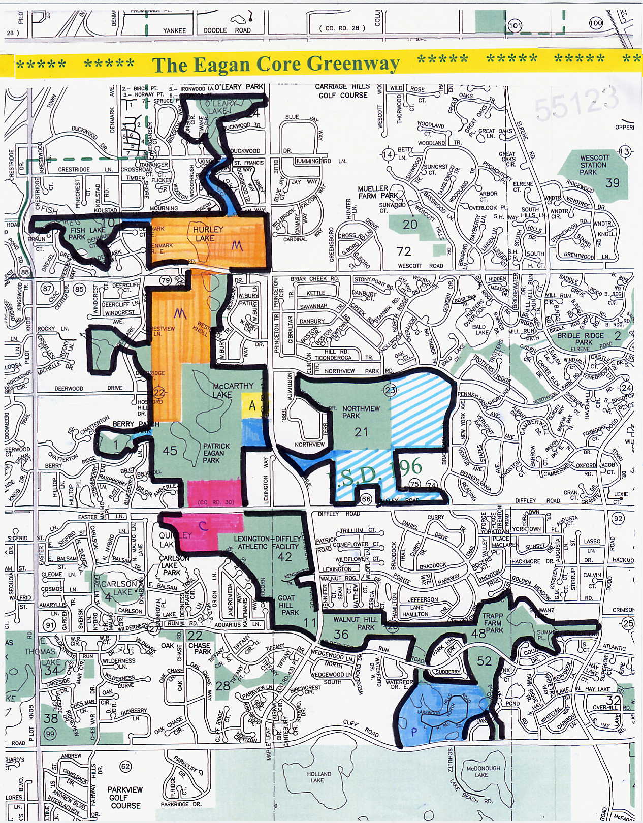
The Eagan Core Greenway,
with Lebanon Hills (south side)
and the McCarthy Farm (north side)
serving as its "Bookends."
M = Patrick McCarthy Farm
A = Anderson Parcel
C = Caponi Art Park
P = Private Properties (along with all areas shown in light blue)
Striped blue areas (north of Eagan High School) = Athletic Fields
Striped blue areas (south & west of Eagan High School) = Wooded Hillsides
|